
-

No equipment installation
-
Easy identification of routes
-
Cost-effective and quick to implement
-
Data collected up to N-5 years: facilitates comparisons with a reference state


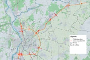
Traffic analysis in Valence
1 million trips analysed from journey time and OD data
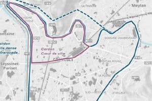
Mobility's study in Grenoble
Monitoring the evolution of vehicle traffic volumes on Grenoble's main roads
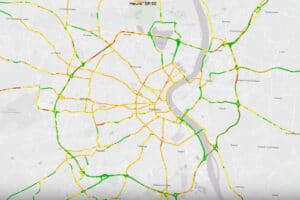
Measuring travel in Bordeaux
Analysis of journey times on 350 km of roads in the Bordeaux conurbation

Sébastien Gomes
Business Development Manager